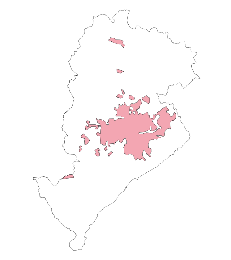
MANCHA URBANA 1935 BELO HORIZONTE
As áreas de expansão da mancha urbana refletem basicamente a ocupação no ano de 1935 em Belo Horizonte.
Frequência de Atualização: ESTÁTICA
|
|
(2025) . MANCHA URBANA 1935 BELO HORIZONTE. http://geonetwork.pbh.gov.br/geonetwork/srv/api/records/b557b675-c186-4c7c-b33a-062c7209ef51 |
inspire
identificationInfo
- Identificador do ficheiro
- b557b675-c186-4c7c-b33a-062c7209ef51 XML
Online resource
- resource_protocol
- WWW:DOWNLOAD-1.0-http--download
Resource identifier
- Languagem
- Portuguese
- Tipo de representação espacial
- Vector
Encoding
- Format
- Version
Projection
- code
- SIRGAS 2000 - UTM ZONA 23 S
Classification of data and services
- Categoria de tópico
-
- Planejamento Urbano e Uso Ocupação do solo
Classification of data and services
Coupled resource
Coupled resource
Classification of data and services
Coupled resource
Coupled resource
noThesaurusName
- All Keywords ( none )
-
- All Keywords ( none )
-
- All Keywords ( none )
-
Other keywords
- ( Tema )
-
- evolucao , mancha , urbana , monitoramento , urbanismo
bboxesSection
N
S
E
W
))
Temporal reference
Temporal extent
Temporal extent
- Data ( Publicação )
- 2025-11
- Data
Quality and validity
- Lineage
- Camada criada e consolidada de acordo com a revisão da legislação de Uso e Ocupação Territorial.
Conformity
Conformity
Conformity
Conformity
Conformity
Conformity
Restrictions on access and use
- Access constraints
- Creative Commons Attribution (CC BY)
Restrictions on access and use
Responsible organization (s)
Contact for the resource
- Organisation name
- PRODABEL - SUGE
- bhgeo@pbh.gov.br
Responsible organization (s)
Contact for the resource
- Organisation name
- PRODABEL - SUGE
- bhgeo@pbh.gov.br
Metadata information
Contact for the metadata
- Organisation name
- PRODABEL - SUGE
- bhgeo@pbh.gov.br
- Date stamp
- 2022-07-28T18:55:43
- Languagem
- Portuguese
- Character set
- UTF8